Property Record
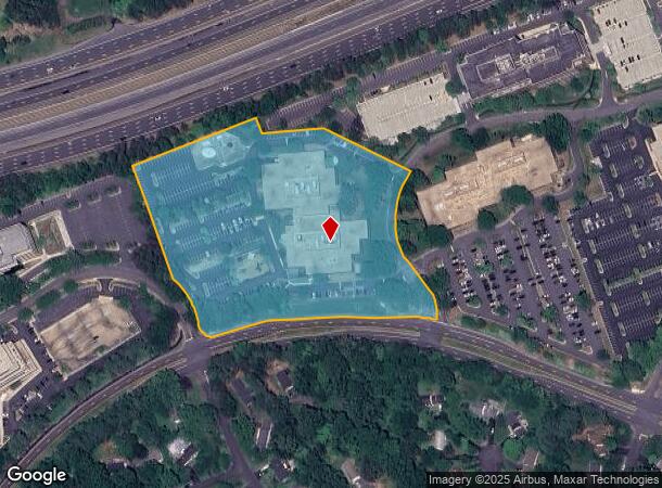
10800 Parkridge Blvd, Reston, VA 20191


Current Lease Availabilities
NEARBY LISTINGS FOR SALE OR LEASE
Property Detail
10800 Parkridge Blvd
Washington-Arlington-Alexandria, DC-VA-MD-WV
Reston
0271-01-0001B
RESTON PT SEC 910
Officebuilding
Fairfax
X
Virginia
51059C0130E
1b
2024
8.10 AC
2025
Reston
482400
Washington, DC
130,498 SF
DEMOGRAPHICS near 10800 Parkridge Blvd
1 Mile
3 Mile
5 Mile
2024 Total Population
5,613
76,279
210,601
2029 Population
5,603
75,778
208,199
Pop Growth 2024-2029
(0.18%)
(0.66%)
(1.14%)
Average Age
43
41
40
2024 Total Households
2,425
32,080
79,927
HH Growth 2024-2029
+ 0.21%
(0.57%)
(1.01%)
Median Household Inc
$161,032
$141,921
$159,474
Avg Household Size
2.30
2.30
2.60
2024 Avg HH Vehicles
2.00
2.00
2.00
Median Home Value
$711,004
$713,675
$769,240
Median Year Built
1983
1982
1984
Nearby Places
- Restaurants
- Banks
- Shops
- Fitness
- Groceries
PUBLIC TRANSPORTATION
AIRPORT
Washington Dulles International
DRIVE
WALK
Distance
Washington Dulles International
19 min
9.1 mi
Ronald Reagan Washington Ntl
DRIVE
WALK
Distance
Ronald Reagan Washington Ntl
34 min
21.2 mi
Freight Ports
Port of Baltimore
DRIVE
WALK
Distance
Port of Baltimore
73 min
53.0 mi
Nearby Properties
Address
Land Use
TOTAL SIZE
Lot Size
Zoning
Address
Land Use
TOTAL SIZE
Lot Size
Zoning
6.67 AC
400
Address
Land Use
TOTAL SIZE
Lot Size
Zoning
1,071,881 SF
373
Address
Land Use
TOTAL SIZE
Lot Size
Zoning
643,232 SF
2.81 AC
373
Address
Land Use
TOTAL SIZE
Lot Size
Zoning
473,458 SF
13.74 AC
540
Address
Land Use
TOTAL SIZE
Lot Size
Zoning
1,096,572 SF
85.06 AC
110
Address
Land Use
TOTAL SIZE
Lot Size
Zoning
446,810 SF
1.12 AC
373
Address
Land Use
TOTAL SIZE
Lot Size
Zoning
450,397 SF
1.07 AC
373
Address
Land Use
TOTAL SIZE
Lot Size
Zoning
275,809 SF
0.75 AC
373
Address
Land Use
TOTAL SIZE
Lot Size
Zoning
332,957 SF
12.68 AC
550
Address
Land Use
TOTAL SIZE
Lot Size
Zoning
532,480 SF
4.62 AC
373
Address
Land Use
TOTAL SIZE
Lot Size
Zoning
469,276 SF
11.42 AC
373
Address
Land Use
TOTAL SIZE
Lot Size
Zoning
498,299 SF
7.40 AC
400
Address
Land Use
TOTAL SIZE
Lot Size
Zoning
560,356 SF
4.33 AC
372
Address
Land Use
TOTAL SIZE
Lot Size
Zoning
407,812 SF
33.12 AC
373
Address
Land Use
TOTAL SIZE
Lot Size
Zoning
337,921 SF
13.57 AC
373
Address
Land Use
TOTAL SIZE
Lot Size
Zoning
437,235 SF
3.33 AC
373
Address
Land Use
TOTAL SIZE
Lot Size
Zoning
264,888 SF
8.59 AC
596
Address
Land Use
TOTAL SIZE
Lot Size
Zoning
411,519 SF
3.48 AC
350
Address
Land Use
TOTAL SIZE
Lot Size
Zoning
263,767 SF
2.34 AC
373
Address
Land Use
TOTAL SIZE
Lot Size
Zoning
394,900 SF
5.30 AC
373
Address
Land Use
TOTAL SIZE
Lot Size
Zoning
274,082 SF
1.08 AC
373
Address
Land Use
TOTAL SIZE
Lot Size
Zoning
337,100 SF
2.19 AC
373
Address
Land Use
TOTAL SIZE
Lot Size
Zoning
337,399 SF
3.06 AC
373
Address
Land Use
TOTAL SIZE
Lot Size
Zoning
320,835 SF
400
Address
Land Use
TOTAL SIZE
Lot Size
Zoning
268,302 SF
11.89 AC
373
Address
Land Use
TOTAL SIZE
Lot Size
Zoning
267,665 SF
1.84 AC
350
Address
Land Use
TOTAL SIZE
Lot Size
Zoning
223,230 SF
400
Address
Land Use
TOTAL SIZE
Lot Size
Zoning
268,374 SF
11.09 AC
430
Address
Land Use
TOTAL SIZE
Lot Size
Zoning
239,175 SF
3.48 AC
373
The World's #1 Commercial Real Estate Marketplace
Connect with us
© 2025 CoStar Group
The information above has been obtained from sources believed reliable. While we do not doubt its accuracy we have not verified it and make no guarantee, warranty or representation about it. It is your responsibility to independently confirm its accuracy and completeness. Any projections, opinions, assumptions, or estimates used are for example only and do not represent the current or future performance of the property. The value of this transaction to you depends on tax and other factors which should be evaluated by your tax, financial, and legal advisors. You and your advisors should conduct a careful, independent investigation of the property to determine to your satisfaction the suitability of the property for your needs.